Some posts may contain affiliate links.
Free Website for Printing Detailed Topographical Maps by Nat Geo
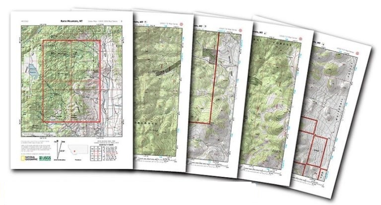
Photo: National Geo
National Geographic has come up with a great program for outdoor enthusiasts of all kinds from photographers to hikers to get detailed topographical maps at their finger tips. This is also good news for preppers who may have to bug out. Best of all it’s free and easy to use!
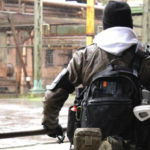
If you plan or have to bug out pre-planning using this free tool will make your chances of success much higher. The majority of maps available are road maps that are great if you plan on driving out and if the roads are not only passable but safe. Topographical maps are typically large and bulky. It can be difficult to find the specific locations you’re searching for. This program divides them into quads that are intended to print on a normal home computer and would be easy to tuck away in your bug out bag.
It’s important to know what landscape you would be traversing. I can only imagine the frustration that one would experience after walking for miles and for hours only to find yourself at the base of an unexpected steep rocky incline that could be from difficult to impossible to climb without the appropriate gear. Or if you should be as directionality impaired as I am at the edge of an unexpected cliff in the dark while exhausted from your trek. Even if you are following along a roadway to insure you don’t get lost on foot. Those maps just don’t give enough detail to tell you what you are in for and staying along the path of a river, roadway, or train tracks these areas may be dangerous because others will be doing the same.
I recommend you use this site or another if you prefer and print out those topographical maps that cover the area you will be traveling in route to your bug out location or where you think you would most likely be traveling if you don’t have a specified bug out location or if that location should have become unsafe. Look for the shortest and safest route that is easiest for your particular group to be going on foot. See the site at the link below
 This is an aggregated site. Please be aware some of the sites we link to could have pop ups. We have no control over them. However, we will never link you to a site that requires you to make any purchase to view the blog.
Please read our disclaimer. We provide you with information from various sites all over the world. The author’s expressed opinion isn’t necessarily that of The Prepared Page or its staff. Our intent is to bring you the information. Use your and your own best judgment when using any information contained within the blogs.
While you’re here check out some of the other posts you may find them interesting!!!
Some posts may contain affiliate links.